Travel
View as
Sort by
Ireland - French
9780717157426
Ireland is a collection of 300 contemporary images of the beauties of Ireland, covering every one of the 32 counties.
€9.99
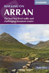
Walking on Arran: The best low level walks and challenging mountain routes, including the Arran Coastal Way
9781786311351
The 45 walking routes in this Isle of Arran guidebook range from easy 5km (3 miles) nature trails to long arduous mountain routes with scrambles (up to 22km), providing thorough coverage of Arran, including an ascent of Goatfell, and nearby Holy Isle. Also includes the 110km Arran Coastal Way, one of Scotland's Great Trails.
€19.76
County Donegal, County Tyrone & County Fermanagh Map | Ordnance Survey Ireland | OSI Discovery Series 11 | Ireland | Walks | Hiking | Maps | Adventure (Irish Discovery Series)
9781912140497
Explore County Donegal, with its rugged coastline, cliffs, historic houses, islands and hidden waterfalls. This OSI Discovery map shows part of County Donegal and Donegal Town as well as parts of County Tyrone and County Fermanagh at a 1:50,000 scale, ideal for exploring this beautiful part of Ireland on foot or by bike.
€8.99
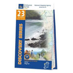
County Mayo Map | Ballycastle & Ceide Fields | Ordnance Survey Ireland | OSI Discovery Series 23 | Ireland | Walks | Hiking | Maps | Adventure (Irish Discovery Series)`
9781912140527
See the stunning cliffs, beaches and rock formations of the Mayo coast and the remarkable Neolithic landscape of the Ceide Fields. This OSI Discovery map shows part of County Mayo at a 1:50,000 scale, ideal for following this stretch of the Wild Atlantic Way and exploring this incredible part of Ireland on foot or by bike.
€8.99
The Mournes Ordnance Survey of Northern Ireland 29
9781905306978
The Discoverer series are designed for tourist and leisure activities. Each one covers an area of 40km x 30km at the scale 1:50,000. There are 93 sheet in the series. 75 are produced by Ordnance Survey Ireland and 18 by Ordnance Survey Northern Ireland. The maps maps produced by Ordnance Survey Ireland are called the Discovery Series.
€12.80
Donegal North-East & Derry Map | Ordnance Survey Ireland | Inishowen Peninsula | OSI Discovery Series 3 | Ireland | Walks | Hiking | Maps | Adventure (Ireland Discovery Series)
9781912140008
Discover the Inishowen Peninsula, Ireland’s largest peninsula, home to breathtaking scenery and the start of Ireland’s famous Wild Atlantic Way. This Ordnance Survey Ireland Discovery map shows the Inishowen Peninsula and north-east County Donegal at a 1:50,000 scale, ideal for exploring on foot or by bike.
€12.81


