Ordnance Survey
View as
Sort by
Display per page
County Donegal Central and County Tyrone Map | Ordnance Survey Ireland | OSI Discovery Series 6 | Ireland | Walks | Hiking | Maps | Adventure (Irish Discovery Series)
9781912140480
OSI Discovery Sheet No. 01 covers part of County Donegal NW at a 1:50 000 scale and is designed for all sorts of leisure activities including walking, cycling and tourism.
€12.86
OS Discovery 71 Kerry
9781912140671
The Slieve Mish Mountains and the Stack's Mountains are two famous mountain ranges to be found on this map. The Stacks Mountains are, for the most part, covered in forestry. The Slieve Mish Mountains are more barren, with Baurtregaum and Caherconree being some of the highest peaks.
€8.99
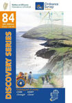
Cork and Kerry Map | Ordnance Survey Ireland | Beara Peninsula | OSI Discovery Series 84 | Ireland | Walks | Hiking | Maps | Adventure (Irish Discovery Series)
9781912140268
Venture to the tip of the stunning Beara Peninsula, studded with Bronze Age monuments, spined by the Miskish and Caha Mountains and stretching out to Dursey Island. Walk the Beara Way, drive the Ring of Beara and uncover hidden highlights with this OSI Discovery 1:50,000-scale map.
€8.99
Ireland Touring Map
9781908852892
One of Ireland's most popular maps, featuring detailed road network, holiday information, scenic routes and city maps. As a bonus this map includes distance chart and index to cities, towns & villages.
€12.86


