Ordnance Survey
View as
Sort by
Display per page
County Donegal, County Tyrone & County Fermanagh Map | Ordnance Survey Ireland | OSI Discovery Series 11 | Ireland | Walks | Hiking | Maps | Adventure (Irish Discovery Series)
9781912140497
Explore County Donegal, with its rugged coastline, cliffs, historic houses, islands and hidden waterfalls. This OSI Discovery map shows part of County Donegal and Donegal Town as well as parts of County Tyrone and County Fermanagh at a 1:50,000 scale, ideal for exploring this beautiful part of Ireland on foot or by bike.
€8.99
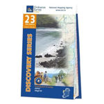
County Mayo Map | Ballycastle & Ceide Fields | Ordnance Survey Ireland | OSI Discovery Series 23 | Ireland | Walks | Hiking | Maps | Adventure (Irish Discovery Series)`
9781912140527
See the stunning cliffs, beaches and rock formations of the Mayo coast and the remarkable Neolithic landscape of the Ceide Fields. This OSI Discovery map shows part of County Mayo at a 1:50,000 scale, ideal for following this stretch of the Wild Atlantic Way and exploring this incredible part of Ireland on foot or by bike.
€8.99
The Mournes Ordnance Survey of Northern Ireland 29
9781905306978
The Discoverer series are designed for tourist and leisure activities. Each one covers an area of 40km x 30km at the scale 1:50,000. There are 93 sheet in the series. 75 are produced by Ordnance Survey Ireland and 18 by Ordnance Survey Northern Ireland. The maps maps produced by Ordnance Survey Ireland are called the Discovery Series.
€12.80
Donegal North-East & Derry Map | Ordnance Survey Ireland | Inishowen Peninsula | OSI Discovery Series 3 | Ireland | Walks | Hiking | Maps | Adventure (Ireland Discovery Series)
9781912140008
Discover the Inishowen Peninsula, Ireland’s largest peninsula, home to breathtaking scenery and the start of Ireland’s famous Wild Atlantic Way. This Ordnance Survey Ireland Discovery map shows the Inishowen Peninsula and north-east County Donegal at a 1:50,000 scale, ideal for exploring on foot or by bike.
€12.81
County Mayo South-West and Galway Map | Ordnance Survey Ireland | OSI Discovery Series 37 | Ireland | Walks | Hiking | Maps | Adventure (Irish Discovery Series)
9781912140596
Discover County Galway and south-west County Mayo including the historic towns of Clifden, in the heart of the beautiful Connemara region, and Louisburgh. This OSI Discovery map shows parts of County Galway and County Mayo at a 1:50,000 scale, ideal for exploring the east coast of Ireland and Connemara on foot or by bike.
€8.99
County Galway Map | Connemara | Ordnance Survey Ireland | OSI Discovery Series 44 | Ireland | Walks | Hiking | Maps | Adventure
9781912140169
Immerse yourself in traditional Irish history, heritage and culture in Irish’s largest Gaeltacht (Gaelic-speaking) region and explore the stunning coastline, islands, beaches, bays and mountains of Galway. This OSI Discovery map shows part of County Galway at a 1:50,000 scale, ideal for exploring this beautiful part of Ireland on foot or by bike.
€12.81
Discovery Series 51 – County Clare and Galway (Irish Discovery Series)
9781912140213
OSI Discovery Sheet No. 51 covers part of County Clare and County Galway at a 1:50 000 scale and is designed for all sorts of leisure activities including walking, cycling and tourism.
€8.99
Wicklow, Dublin & Kildare Map | Ordnance Survey Ireland | OSI Discovery Series 56 | Ireland | Walks | Hiking | Maps | Adventure: Wicklow. Kildare
9781912140343
Explore County Wicklow, the “Garden of Ireland”, a region of lush natural beauty just 22 miles south of Dublin. This OSI Discovery map shows much of County Wicklow, as well as parts of southern County Dublin and eastern County Kildare, at a 1:50,000 scale, ideal for exploring this beautiful part of Ireland on foot or by bike.
€0.00


